
Whitney ZIP Code Working Map
The official Clark County ZIP map supports 89122 and 89011 as the working Whitney-area ZIP evidence. It also displays 89121, 89120, and 89142 nearby, but proximity on a countywide display map does not establish service to a Whitney address. No official machine-readable list was found that assigns every current Whitney Census-designated-place address to a ZIP. The table therefore separates supported map context from a final address-level determination.
| ZIP | Whitney-area indication | Post office answer | Use and limit |
|---|---|---|---|
| 89122 | Shown on the county ZIP map; a captured GIS parcel reads CC Whitney - 89122. | Confirm with USPS for the exact delivery address. | Strong parcel example, not complete CDP coverage. |
| 89011 | Shown as Whitney-area map evidence. | Confirm with USPS for the exact delivery address. | Working-map indication, not a complete parcel crosswalk. |
| 89121, 89120, 89142 | Nearby county-map context. | Use USPS only after entering the full address. | Do not treat nearby labels as Whitney service proof. |
The Clark County ZIP boundary map was created January 3, 2019 and carries a display-only, no-liability disclaimer. Pair it with the county’s current GIS service for parcel geometry, then retain the retrieval date. The map is useful for visual context, but it is not a municipal-boundary map or an address-by-address list of residents.
Note: A ZIP pinpoints delivery geography, while the parcel layer, Census boundary, and county planning map answer different Whitney geography questions.
Search the Whitney ZIP Code Directory
Use an address-first sequence when a ZIP is the starting point. The county Assessor and GIS can connect a normalized address to an APN, legal situs, and jurisdiction. The ZIP then narrows a record search, but it cannot show everyone in a delivery area. A ZIP-wide result may include addresses beyond the Whitney CDP, and a parcel with a Las Vegas mailing city can still have a Whitney situs. Record which system supplied each field.
- Enter the complete address, city, and state in USPS ZIP Code Lookup to obtain the standardized delivery result and ZIP+4 where available.
- Open the address or APN in the Clark County Assessor search, then copy the parcel number, situs, and legal town field.
- Check the parcel in GIS and compare its jurisdiction and the county ZIP layer. A polygon intersection is stronger than a broad map label.
- Use a ZIP-capable county search only for its stated record purpose, then move to the Whitney street records when the question becomes a specific street or parcel.
The Assessor search accepts street number, direction, street name, type, and city or town. If an exact number fails, a nearby address, map geometry, subdivision, and APN can bridge the search. Preserve unit and suffix details separately. The county’s parcel systems treat the 11-digit APN as a stable bridge between Assessor, GIS, Treasurer, Recorder, and parcel-map records.
Use USPS for Whitney ZIP Codes
The USPS ZIP Code Lookup is the authority for the delivery ZIP of one exact address. It asks for address, city, and state and returns standardized delivery information. County GIS and the official county map serve a different purpose: they show parcel and boundary context. A delivery ZIP does not guarantee that a postal city, business location, legal town, or Census place uses the same boundary.
| USPS field or result | How it helps a Whitney ZIP check |
|---|---|
| Street address | Supplies the delivery point. Include any apartment or unit information when known. |
| City and state | Helps USPS normalize the requested delivery address without deciding the legal town. |
| Standardized address | Provides the form to carry into Assessor and GIS searches. |
| ZIP and ZIP+4 | Identifies the postal delivery code; keep it distinct from the parcel’s jurisdiction. |
ZIP+4 is a delivery refinement within a five-digit ZIP. It is not a small neighborhood boundary. A carrier route is a postal delivery sequence, not a map of who lives in a block. The research did not locate an official post-office assignment for every Whitney address, so the exact address lookup is better than naming one post office for the entire community.
Whitney ZIP Code License Fields
ZIP can also be one filter among several in the County’s business-license records. The Clark County Business License Search supports business name, owner, business address, parcel number, category, date, status, ZIP, and license number. The ZIP field can narrow a location-focused search, but it does not establish that a business’s mailing address, every related person, or the full ZIP area is in Whitney.
The captured county license-search portal shows ZIP-related result context for a location-focused search.
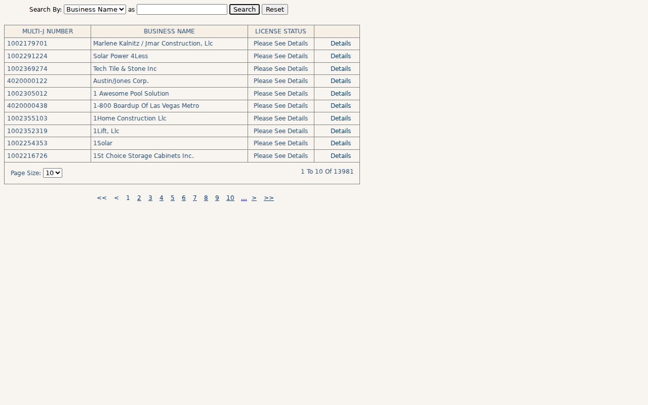
Result cards in the inspected portal can show a business name, multi-jurisdictional license number, location or mailing address, primary jurisdiction, status, issue date, classification, land-use or zoning, parcel number, district, township, and commissioner district. Search by location or APN when the parcel is known, and try punctuation and DBA variations for names. A matching ZIP is only one field in a record with several geography labels.
Whitney ZIP Code and CDP
A useful comparison keeps ZIP statistics and Census statistics in their own columns. Census QuickFacts reports Whitney CDP at 49,061 people in 2020, up from 38,585 in 2010, with 6.81 square miles of land area. Clark County’s 2024 ZIP population material lists 56,972 for ZIP 89122, with 55,683 in 2023 and 55,706 in 2022. The ZIP total is larger because it includes territory outside the Whitney CDP. It should never be relabeled as a Whitney population count.
| Geography | What the number or boundary describes |
|---|---|
| Whitney CDP | Census statistical place, including the reported 2020 population and land area. |
| ZIP 89122 | Postal area used in the county’s ZIP population material, including territory beyond the CDP. |
| Whitney planning area | County planning geography, which is not interchangeable with the CDP or a delivery ZIP. |
This is the local comparison that matters most: a ZIP code is larger or differently shaped than the Census place it appears to name. Whitney planning geography also includes unincorporated county islands inside Henderson, another reason to test an individual parcel rather than derive town status from a postal label.
Map a Whitney ZIP Code Parcel
Clark County GIS OpenWeb is the map cross-check after USPS standardizes an address. A selected parcel can expose owner name, site address, jurisdiction, sale date and price, lot size, construction year, recorded document number, land-use-plan area, legal description, flood context, elected officials, and links to other county systems. The captured example combines CC Whitney - 89122 with the Whitney land-use-plan area, but that one parcel is an example, not a universal rule.
Use the GIS OpenWeb viewer with the ZIP Code Boundary, Whitney Town Advisory Board, Commission District, and Las Vegas Valley Street Map layers available from the county map collection. Parcel lines are not the same as a postal boundary, civic district, subdivision, or neighborhood association. GIS geometry is a strong locator, yet the county disclaimer means it should be checked against the recorded instrument for a title question.
Note: A current owner field, mailing address, or sale value should be tested against a dated recorded document before it is treated as a property fact.
Whitney ZIP Code Precinct Split
ZIPs and election precincts answer different questions. ZIP is a delivery code, while Clark County Elections manages registration, precinct and district data, walking lists, voting history, and election information. The county’s public voter-data files are updated weekly and separate active, inactive, and canceled records. A precinct-based list can help with a lawful, documented precinct or district question, but it is not a census of the people who live in a ZIP.
The individual voter service is identity-gated and intended for the voter. NRS 293.558 protects Social Security, driver-license and ID information, election email, and allows address and phone withholding. For an address near a boundary, confirm the delivery ZIP with USPS, confirm parcel context in GIS, and then consult the Clark County Elections route for precinct or district information. Do not use a ZIP label to infer voting information.
Whitney ZIP Code Boundary Limits
A ZIP is neither a city limit nor an ownership, school, court, or Census boundary. The same street can use differing ZIPs or postal-city labels, and a ZIP can cross Whitney planning edges. This is why the working-map evidence for 89011 and 89122 is deliberately cautious. It is useful for narrowing an address search, but it does not prove that every address under either label is inside the Whitney CDP.
- ZIP code
- A five-digit postal delivery geography. It does not define a town’s legal limits.
- ZIP+4
- An added delivery refinement for a more specific mail segment within a ZIP.
- PO-box ZIP
- A ZIP used for post-office-box delivery. It should not be assumed to describe street delivery territory.
- Unique ZIP
- A ZIP associated with a single organization or large delivery destination, not a general residential district.
- Carrier route
- A postal delivery sequence that does not create a civic or property boundary.
The official map does not supply the missing complete crosswalk or a post-office list for every Whitney address. The reliable fallback is full address to USPS, then the current GIS parcel and ZIP layer, with the source date recorded. That sequence narrows an address without overstating what the available maps prove.